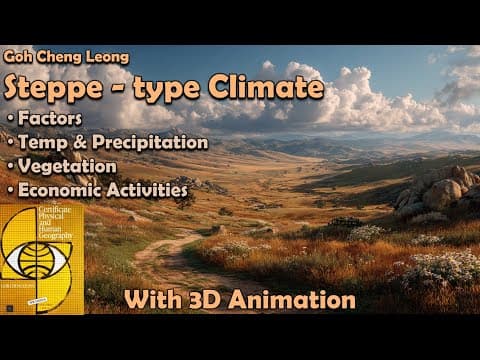
[0:11]Hello friends, welcome to another video of Zeta axis and today we are going to discuss the temperate continental type of climate or also called the steppe climate. Now here, we can see there are two words: the temperate word. This word basically means temperate region, that is, the region polewards of the tropical region. That is, these regions are polewards of the Tropic of Cancer and Tropic of Capricorn. Continental means that the region which is in the center of the landmass, that is, away from the coastal regions. So here the maritime effect is very less. You will see the extreme of temperatures because the coastal region is far away. The moderating effect of oceans or water in the sea is not available over here. Now here we can see all the climate regions classified by GC Leong and out of which here this green color, it indicates the step type of climatic system. This type of climatic system can be further seen in Australia over here. Similarly, we can see this climatic system in North America, in the center of South America, as well as in Africa. So we can see this type of classification system can be seen in almost all of the continents. Let's see the factors which lead to these temperate grasslands. Here this green color, it indicates the regions which have steppe type of climate. Now we can clearly see that these regions are far away from the coastal regions, specifically in the Northern Hemisphere. Now, the winds which are blowing over here are mostly westerlies. And these westerlies, they are blowing from land towards the ocean. Now here, they do not have much moisture. They cannot bring rainfall to these regions. And therefore these regions have aridity. Here are the factors: it lies in interior of land, away from oceans, lies in westerlies belt. Westerlies loose moisture before reaching here. So because they are so far away, the westerlies cannot bring rain up to them because first of all, the westerlies do not have moisture and even if the westerlies come from this region, they will lose their moisture because it is located far away from the coastal regions and that is why we do not see much rainfall in these regions. Now these grasslands are treeless. Northern Steppe climate: extreme climate. Southern hemisphere steppe region: moderate climate. Because of narrow continents, and closure to coastal region. So as we have seen in the previous slide, that in the Northern Hemisphere, the continents have very broad landmass and therefore, the inner regions are far away from the coastal regions. Therefore, northern steppe climate has extreme climate, that is, extreme temperatures are there. While in Southern Hemisphere, the continents are very narrow, be it South America, Africa or Australia. The continents are narrow, coastal regions are closer, the moderating effect of the oceans is there. Therefore extremes of climate is not seen. Now, the temperate grasslands are generally on polewards side of deserts and Mediterranean region, in interiors of continents, in Southern Hemisphere, on windward side of mountains. So we can see that they are in the interior of continents and this yellow color which we see, these are the deserts. So we can see that they are closely located to the deserts. Similarly, here also we can see these are the deserts. And this green color, these are the Mediterranean region. Even in all these hemisphere, there is also this Mediterranean region. Even in South America, we can see this is the Mediterranean region, these are the hot deserts of Atacama and here we have the Patagonia Desert. And similar thing can be seen in Australia, where we can see that these are the Mediterranean type of climate. And these are the deserts. So it is very closely located or located polewards side of deserts and Mediterranean region. It is located in interior of continents, which we can clearly see because all of those are located in the center of the continent. Even here, if you see then these regions are also in the center of continent. The sea is very far away from these grasslands. Now here, because the landmass is very narrow as you can see. Therefore they are lying near the coast but because of the Andes Mountains which are here, which are present on the border of this South American continent. Therefore, the westerlies which are coming from here, from in this direction, they are blocked by these Andes over here and therefore a certain type of aridity is felt in this region, that is why there is less rainfall. Here also you will see that westerlies have to travel lot of land before they reach this region. Therefore they lose all their moisture and they do not give much rainfall in these regions. Now, let's see the comparison of Northern Hemisphere and Southern Hemisphere. So we have extensive grasslands. Here the grasslands are very large. Reason is, there is broad continents and the central landmass which is far away from the oceans is very big. Therefore we have broad grasslands. You can see this is North America and this is Asia. The grasslands are very broad. But when we come to south, southern hemisphere, we will see narrowness of continents in temperate region, in temperate region. Remember temperate region is below Tropic of Capricorn. So in this region, the continents are very narrow, it is South America. Even here we can see Africa is narrow and even Australia is relatively narrow. Therefore, the grasslands are restricted to smaller regions. So here we have extensive grasslands because the continents are wider. Here we have smaller grasslands because the continents are narrow. They are spread over thousands of km. Continentality effect, far away from oceans, severe climate. So because the continents are broader, even though they are very large extensive grasslands, they are still very far away from the coast. And therefore there is an effect of continentality and we see severe climate. Here the grasslands are restricted because of narrowness, but they are closer to the oceans as we can see they are just very close. Even here they are right up to the coast of Atlantic Ocean. And even in Africa, we can see that they are just along the coast. Therefore, the moderating effect of oceans can be seen over here and the climate extremes is not there. Continentality is reduced, moderate climate is there. So the winter temperature is severe in Northern Hemisphere, while winter temperatures are mild. Reasons we have seen because of the continentality effect in the Northern Hemisphere, while the moderating effect of Southern Hemisphere. So the temperature of winter, we can see it can go below -10°C, reaches below freezing point and snowfall can occur in these regions. Average annual temperature range is also very high. So because the winter temperatures can go below -10°, while the summer temperatures are above 20. You can see there is very big difference, almost 30 degree difference between the maximum and the minimum average monthly temperatures. But when we come to the Southern Hemisphere region, we can see that the temperatures in winter do not go below 10°C. So their winter temperature is rarely below 0°C and snowfall in this region is not common, they do occur but they are not common. Annual temperature range is small. We can see that the temperature range that is maximum monthly average to minimum monthly average, it is smaller and it is because of maritime effect, effect of the oceans. Now let's see the temperate grasslands distribution. First, Eurasia. So the temperate grasslands here are called Steppes and it is because of these steppes, this whole climate is called steppe climate. It stretches over 3200 km, from Black Sea to Altai Mountains. So here we have these Steppes. And we can see that here is our Black Sea and here we have these Altai Mountains. So it stretches horizontally from this point, this is nearly we are in Hungary. And from here, it will stretch right up till this region, across the China. So we can see that this whole distance is 3200 km, which is very huge. It covers Russian plain region and it is broken in few places by Highlands. So it is continuous but there are certain regions which are isolated. So first is Puszta grassland of Hungary and then we have Manchuria grasslands of China. So these three grasslands are actually one common belt. They are having in between deserts and mountains, but they have part of similar type of climate. In North America, we have Prairies. And these are the extensive grasslands found in the Central US as well as Southern Canada. They also cover large continuous areas. So we can see they cover very large continuous area. We have US right over here. Here is the Great Lakes and north in this northern portion it will be south of Canada. So it is between Rockies and Great Lakes. There are the Great Lakes. Here we will have Rocky Mountains and then it is across US Canada border. So it starts right from US Mexico border and it can go up in the southern Canadian region. In South America, we have Pampas, where we have Argentina and Uruguay. So it is mainly spread across these two countries. It is spread till Atlantic coast, so we can see that it is adjacent to Atlantic coast and it has very high maritime influence. So because it is very close to the ocean, there will be maritime effect.
[10:28]There will be moderating effect of the oceans and we will not see very extremes of temperature. Now moving to Africa. Here the grasslands are called Veld. These are grasslands of South Africa, sandwiched between Drakensberg and Kalahari Desert. So we have Drakensberg, which is along this coast. And then we have Kalahari Desert right over here. So these grasslands are between the Kalahari Desert and the mountains over here. These Velds, they can be further subdivided into Bushveld, that is tropical type of bushes are there and this are the southern part of Veld. So the southern part of these grasslands are called Bushveld, while Highveld are there. These are temperate type in the for they form the northern part of these Velds. Now these are the temperate grasslands which we can see. Here is Prairies, Pampas, Puszta, Steppes, Manchuria, Veld and Downs. Now let's see the temperature characteristics of the temperate grasslands of Northern Hemisphere. So we have seen that these grasslands are very far away from the oceans. Therefore, there is very heavy effect of continentality due to distance from the oceans. And we can clearly see it in this curve. This yellow curve, which indicates the temperature. We can see that the winter temperatures can be very less. It could go till -10, -20 even can occur. And the summer is as high as 20 or even above 20. So there is almost 30 degree difference between winter average temperatures and summer average temperature and it is because of continentality. Summers are warm. It can go around 25°C. Winters are very cold. It could be around -15°C. Winter temperature can drop below freezing point. 0° is the freezing point. So we can clearly see that the temperature easily falls below 0°C, which leads to snowfall. Some places experience -20°C to -30°C. Annual temperature range is very high. We have seen the difference between maximum average monthly temperature and minimum average monthly temperature is 30°C or even higher. And therefore we have very high temperature range and it is because of continentality. So this range is two to three times the annual temperature range in Southern Hemisphere. So you can see that the continentality effect is very severe in the Northern Hemisphere because of the large landmass because of the width of the continents in the Northern Hemisphere. Now, if we see the Eurasian Steppes are covered with snow for several months. So here because the temperature easily drops below 0°C, we can see that the grasslands are covered with snow for several months. Snow melts with return of spring and temperature rises rapidly. So when the sun comes up, it starts to melt, the water is provided to the grasslands. So when the summer comes, you will see green grasslands. Now let's see the Southern Hemisphere temperature characteristics. Climate is not severe. Here we can see that the winter temperature does not drop below 10°C. You can see this is a very huge difference. Where in the Northern Hemisphere, temperature could easily go below -10. Here it is not even going below 10°C. Because of maritime effect which moderates the climate. Summers are warm. Here you can see the summer is around 20 to 22°C, while the winters they range between 2°C to 12°C. It rarely crosses below freezing point. So the temperature very rarely will go below 0°C. So we can see the huge difference between the winter temperatures in Northern Hemisphere and Southern Hemisphere. And it is because of continentality, that is, distance from the sea. Now let's see the precipitation characteristics of Northern Hemisphere grasslands. So they are heavily affected by continentality due to distance from the oceans. So even temperature as well as precipitation, both are affected by continentality. Annual precipitation less, generally less than 50 cm. It depends on location. So exact value will depend on the location, but this is the expected amount of precipitation annually. Summer maximum. So we can see here that the maximum rainfall occurs in summer, that is concentration of rainfall is in the summer. While winter rains in form of snow, because the temperature is below -10° or it is below 0°C. So we will see that in winter, the precipitation is in the form of snow. In Northern Hemisphere, there is a summer maximum and it is because of convectional rain also, which causes rainfall. This type of rainfall mainly occurs because the sun heats the landform. When the land is heated, the air which is closer to the ground, it will get heated and it will rise up at a very high velocity. Now even though there is very less moisture in the air, but it will have some moisture. This air when it rises very quickly in the upper atmosphere, the moisture which it carries, they will also be cooled down, there will be adiabatic cooling. And because of this cooling, we will see that clouds formation will start. And these clouds will give torrential rainfall. So this is convectional rain and this is confined to smaller regions. But in the summers, the convectional rains add in the total rainfall in this region. That is why we have summer maximum. In Northern Hemisphere, winter rains also occur by occasional depressions brought by westerlies and they are generally in the form of snow. So we saw that in summer, it was convectional rain because of heating of the land, which caused the air to move up. But in the winter, rain occur by depressions which are brought by westerlies. And here we can see the wind system. This is our Northern America and this is our Central Asia. And if we see the wind flow in these regions then we can see that the winds are moving from here. And these westerlies which are crossing the Rocky Mountains, they are bringing rainfall in this region. Similarly, here also we can see that the wind is moving in towards these regions from the western direction. So these are the winds which bring depressions with them and they cause rainfall in these regions. Here is the combined rainfall summary. So we see that rainfall here mainly occurs due to convection in summer and winter rains mainly occur because of occasional depressions brought by westerlies. Now let's see the precipitation summary in Southern Hemisphere. So they are heavily affected by maritime, closer to the oceans, so the oceanic effect is also higher. Annual precipitation therefore is more than Northern Hemisphere because the local winds which are blowing over here, they will carry moisture from the ocean towards the land. And therefore, the amount of rainfall or precipitation in this region increases. They also have summer maximum. Here, January-February is the summer season in Southern Hemisphere. So we can see there is summer maximum. There are three months of no rain. So we can see that there are certain months in which the rainfall is negligible. There is drought season. Agriculture needs irrigation. So in this period, the agriculture will need irrigation. Now Chinook is a very important local wind which occurs in Northern America and it brings warm wind to the steppe regions. So the Chinook winds are basically winds which blow from the Pacific Ocean and they cross over the Rocky Mountains and they enter this region which has steppe climate, basically Prairies. This is our Prairie region or Steppe grassland. Now if we see closer to this region, we can see that here we have Rocky Mountains. This is Pacific Ocean and these are the grasslands. Now the wind, we can see it rises up over here towards the Pacific. Here it will give lot of rainfall. Then as it moves, the air will lose its moisture. When it descends over here, the air is adiabatically heated. And it gets warmer. The yellow color indicates the warm air, the blue color indicates the colder. So here we can see because of adiabatic heating, the temperature of this air has increased. Now whatever cold climate or snow is there over here, this air will melt that snow because of its warm temperature. It raises the it raises the temperature of this region above the freezing point. That is why the wind rises over Rockies Mountains and then descend in Canadian Prairies and Great Plains of US. Chinook means snow eater. Chinook. On windward side causes heavy rain. Over Rockies it causes snow. On leeward side it causes snow melting and increases temperature. Because they are warm and the air adiabatically heated. Therefore they melt the snow and that is why they are called snow eaters. They are on the windward side causes the heavy rain. So towards the Pacific Ocean, the Chinook wind will cause rainfall. But over the Rockies it will cause snowfall. And when it descends in the leeward side, it causes snow melting because now it has been adiabatically heated and it has become a warm air. What are the effects of Chinook wind? It melts snow. Pastures, grasslands available for grazing. Cattle can graze in open. Chinook is hot wind. Raises temperature, leading to mild winter and helps in farming. So Chinook wind basically helps in farming. It melts the grasslands and animals can be left to graze. The temperature is also increased over here. Now let's see the natural vegetation which is found in the steppe type of climate. Here is the comparison between Savanna and temperate grasslands. We have studied Savanna grassland in another video, but here we can see the comparison between them. Grasslands are interspersed by trees. We can see here that they are trees, there are grasslands but scattered trees are also there. Here in the steppes grassland, we see there are no trees. So the temperate grasslands are without trees. They are treeless. They are true grasslands. Grass is longer. It could be up to 15 ft. These are called elephant grasses. Here in temperate grassland, the grass is generally shorter. Annual rainfall is relatively higher. You can see the vegetation. The trees are there which require large amount of moisture compared to the grasses. So it can exist only because there is rainfall higher. While here, there is is a very less amount of rainfall. Therefore we do not see any trees because trees will require sufficient moisture, which is higher than the grass. Now let's see the natural vegetation. Temperate grasslands are treeless. We have already seen in the previous video that because the rainfall is not sufficient, the trees cannot exist in these grasslands. Therefore, they are virtually treeless. Grass needs less rainfall. 25 to 50 cm rainfall is adequate for them. Grass growth is not abruptly checked by summer drought or winter cold. These grasses, they can lie dormant for long time. And by long time, I mean, it could lie for months. It becomes active when moisture is available. Grass can grow with limited water. And that is why we see grasses in this region because the requirement of moisture by grasses is less, while trees require large amount of moisture. And when the dry season is there, then the grasses, they will set everything which is above the soil, only roots will be alive, they will become dormant till the moisture is available. This cannot be run by trees. Therefore, in this steppe type of climate, we will see grasslands and no trees. Now, as we move polewards, precipitation increases in the form of snow. So we will see coniferous trees. They will start to come up. While when you move equatorwards, we will see that the rainfall will decrease and the grasses will become shorter and sparser and they will gradually convert into desert region. So on the northern side, it will transform into coniferous forest. On the southern side, it will transform into desert region. Now, the temperate grasslands have different seasons. So let's see what are the characteristics in different seasons. In spring, small rainfall stimulates growth and we see green grass, fresh, blooming with small flowers. So there is availability of small flowers, small grasslands becomes green. Summer, heat and evaporation. Grass dries and turns yellow and soon brown. So here we see that if there is lack of moisture and high heat is there, then the grass dries out. In autumn, the grass withers and dies. Only roots remain alive and dormant. So they will wait for the water in the spring season. And when the water is available, the grass will again become alive. So this is the cycle followed by the temperate grasses. Now, if we see the Prairies of North America. Specifically, Prairies of North America, they have grass generally shorter. But where the rainfall is greater than 50 cm, then grasses could be a little bit taller as we can see over here. And these are called long Prairie grass. Now in these grasslands, because there are no trees or mountains for very large distance as you can see over here. Therefore, the winds, they will blow with very high velocity. In order to protect the house from these winds, double row of trees is planted around the houses or living quarters. So we can see double rows of trees are planted around us to shield from winds. If you see the steppes of Eurasia, then they are spread across Ukraine to Mongolia and even in China. Ukraine has chernozem, which is this rich black soil. And the continental interiors of Asia have rainfall less than 50 cm. Rainfall is also unreliable in these regions. Therefore, the grass is shorter, wiry and sparse. So we can see the grasses are not very much greener in color but they are wiry. They have less foliage. Now let's see the economic activities by the people living in these regions. So historically, the steppe climate was a grazing animal zone. Here, you could find large number of wild animals. Wild horses in Asian steppes were found. Bison was found in Prairies of North America. These are the bisons. Buffaloes were found in Pampas, that is South America. And these regions were dominated by nomadic tribes which used to herd cattle. Kirghiz in Asiatic steppes. These were nomadic herders. Then we have Red Indians of North America. They were hunters and mainly bison hunters. So we can see these are the Red Indians which are try to hunt these bisons. Cultivation was unknown to this region and the population density was very less. However, changes to grassland occur when the settlers came and the mechanized wheat cultivation started. Grasslands are now Granaries of world. Maize is also cultivated in warmer region. So you can see that this region was now transformed for cultivation, for agriculture purpose. Wheat is now grown in large amount. Corn is also grown in these regions. Corn and maize are same thing. Now in South America, even in other places, the tufted grass which are indigenous grasses of this region, they were not nutritious for the cattle. So they were replaced by alpha alpha grass so that the cattle can graze the region and sufficient nutrition could meet them. Ranching regions were also made in this regions so that the cattle products, right from dairy to meat could be generated. And it is more concentrated in the Pampas of South America. Nomadic herding, it has almost disappeared from grasslands now. Herders were wandering tribes. They would used to wander from one place to another place in search of pastures for their cattles or for their animals. Kirghiz, Kazakhs, Kalmuk, these are the examples in Central Asia. They used to travel long for grass and water for cattle, sheep and horses. Animals were used for meat, milk, wool, hides, bones and horns. So you can see that almost all of the animal extracts were brought into use. Wool for used for felt for tent and garments. Leather, boots, saddles and belts. Bones and horns were used for making tools and utensils. They also traded these products in the local markets. However, during the communist war, the Kirghiz and Tartars, they resisted the communist but they were forced to settle after these communists were defeated. Now in the Northern America, we see that the cultivation is highly mechanized. Grasslands are ideal for extensive farming because cool moist spring stimulates growth. In the spring, the temperature is warm enough for the growth to continue. Sufficient amount of rainfall or irrigation provides the required amount of water. Light showers during ripening period helps swell the grains. So there is long summer where the rainfall is very less. Therefore, they get sufficient temperature and time to ripen. Warm sunny summer, ideal for harvesting, helps straw dry. So because the summer is intense without rainfall, it helps in harvesting as well as the straw dries out, which can be used for various other purposes including manuring as well as animal fodder. Now these grasslands, as you can see, they are flat. And this helps in cultivation, especially mechanization of these regions. Mechanized farming, however, leads to low yield. So remember, because of mechanized farming, the yield per hectare is less. However, yield per man is very high. Yield per hectare of other countries with intensive farming is much higher compared to the mechanized farming of these regions. Now, winter wheat is also grown in US Prairies and other regions, which is the most common type of wheat. Almost 70 to 75% of the total wheat cultivated around the world is winter wheat. It is of good quality. But spring wheat is cultivated in in regions where the winter is severe.
[28:57]So Canadian Prairies, you will see here in blue color, which indicate spring wheat. And here also in the colder regions where the winter is very severe, they will sow wheat in spring season.
[29:31]So these weeds are sown over here. These are very less, almost 1/4 to 1/3 in the total amount of wheat produced across the world. And they are generally not of very good quality because they do not get sufficient temperature or sufficient time for ripening. Now pastoral farming. Before settlers, the region had few animals, few cattles. Settler brought large number of animals with them. Because the natural conditions, they suited animal farming. And the thus we saw cattle, sheep, pig, horses introduced in this region. Refrigeration further allowed meat production in this region as well as dairy products in this region. Therefore, the animal rearing became a business, a fruitful business in these regions. And the export of beef, mutton, wool, hide, milk, all of these were possible mainly because of refrigeration and road connectivity. Now, Southern Hemisphere climate is more suitable for animal rearing because evenly distributed rain, the temperature is mild, mild winters are there due to maritime effect. The tuft grass, which was having less nutrition, was replaced by alpha alpha grass. So that the animals can now get sufficient nutrition. Wild breeds were cross bred. Foreign breed were also imported and they were also cross bred. So good quality of cattles or animals for domestication were also produced. Now because of this pastoral farming, pastoral industry came up. That led to the development of pastoral industry. Large ranches were established. Meat packing industries came up and export of meat started. So here because of free and open grasslands, mild temperatures which does not require building of shelters for the cattle. So it became very economic to have cattle rearing and large number of cattles could be have. Because of the large concentration of these type of ranches, meat industry could be developed. And therefore meat packing industries became normal. It became a major source of economy. Ports were also formed. Buenos Aires, which is the capital of Argentina, Bahia Blanca, Fray Bentos and Montevideo. All these regions became ports because of the increasing export of animal products, be it meat or be it dairy. So with this we will conclude our video on the steppe climate as discussed in GC Leong. I hope you have liked the video. If you have liked the video, then do subscribe to the channel and share it with your friends. If you like what we are doing then you can help us or support us using the Paytm ID. Thanks for watching the video.


