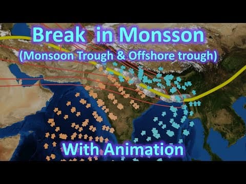
[0:11]Hello friends, welcome to another video of ZETA AXIS and today we will discuss about breaks in monsoon rainfall. This is a topic which we come across when we are studying NCERTs, but it is not discussed in detail in NCERTs that what is the mechanism of breaks in monsoon rainfall or what causes this break. So we will discuss in detail the reasons for this break in monsoon rainfall. There are mainly two mechanisms, monsoon trough and offshore trough which causes breaks in monsoon rainfall. Now there are a list of factors which affect the amount of rainfall during monsoon season. These are some of the important factors which affect the rainfall in India. We have discussed all these topics in their separate videos and today in this video we will be discussing about monsoon trough and offshore trough. Let's first try to understand what is break in monsoon. Now whenever there is a monsoon season going on and there passes a week or more when there is no rainfall within this monsoon season, then it is called a break in monsoon. The break in monsoon occurs through two different mechanisms. One is effective in Northern India that is caused by monsoon trough and another is in the western coast along the Maharashtra, Goa, Karnataka and Kerala coast where offshore trough is formed. Now the NCERTs define that break in Northern India occurred because the rain-bearing storms are not very frequent along the monsoon trough or the ITCZ over this region. Now we will understand what is the meaning of this in the later part of the video. Just remember that the break in Northern India is caused by monsoon trough, the break in Western coast is caused by offshore trough. In our later videos, we have discussed migration of intertropical convergence zone in detail. So let's just see a quick summary of it. We see that in different seasons, different parts of our Earth is facing the Sun directly. So in the summer season, we see that the Northern Hemisphere is directly under the sun. The Sun rays are directly falling over the Northern Hemisphere, over the Indian region and it is heating this region, the region the zone by this yellow dots. So therefore this region will have maximum heat and therefore the intertropical convergence zone will be located close to this yellow dotted line. During the spring season, we see that the Sun rays are falling directly over the Equator. So the Equator is receiving maximum amount of heat and the ITCZ is also located close to the Equator. In the winter season, we see that there is summer in the Southern Hemisphere and the Sun rays are falling directly over the Tropic of Capricorn. So the ITCZ is also located close to Tropic of Capricorn and similarly in Autumn, we see that the Sun rays are falling directly over the Equator again and therefore the ITCZ is close to Equator. Here, we can see the movement of Intertropical convergence zone with the movement of Sun. We can see that Sun is close to Tropic of Capricorn so Intertropical convergence zone seem something like this, it is more in the Southern Hemisphere. Now when the Sun moves in the Northern Hemisphere, we see that Intertropical convergence zone also moves in the Northern Hemisphere and it is located over the Indian subcontinent in the month of July. So this is how the ITCZ moves along with the position of Sun. The arrival of monsoon in India is linked with the migration of ITCZ towards Indian subcontinent. Here, we can see that the red line indicates the Intertropical convergence zone. In the southern direction of this ITCZ, we see monsoon winds. Now as this ITCZ moves in the Northern direction, we see that the monsoon winds also move over Indian subcontinent and give rainfall to the Indian subcontinent. So this movement of ITCZ plays a very important role in bringing monsoon to India. So what is a monsoon trough? Monsoon trough is a portion of ITCZ Intertropical convergence zone which extends into or through a monsoon circulation. So remember, it is a portion of ITCZ which extends into or through a monsoon circulation. Now let's try to understand what is a trough first, to get a clear understanding of monsoon trough. So here we see that there is a low-pressure region. This is a low-pressure cell. But this low-pressure cell extends, it is elongated in this direction. We can see that this is the extension of low-pressure region. Now here we see that there is an extension of low pressure in between high pressure region. So if we consider this line, we will see that there is high pressure over here, but as we move towards this line, the pressure decreases. So because of this reason, we will see that winds from the edge will move towards this low-pressure region. Moreover, if we move from this direction towards this direction, we see that pressure decreases. Therefore, air generally moves from here towards this trough and then moves along the trough towards the low-pressure region. This is a very normal phenomenon and this is called a pressure trough. Here in this video, we can see formation of a low-pressure trough in our Indian subcontinent. We can see that it starts from the region in Pakistan or from the Western India direction and then it extends to our Bay of Bengal region. So this is this dark blue color is our pressure trough. We can see that it starts almost from the Bay of Bengal and extends towards the Punjab region. Here is a closer look of this pressure trough. We can see that how it is extending towards the Bay of Bengal region. So we have tried to represent that pressure trough by these red lines where we can see that there is a low-pressure region over here and that pressure trough is extending towards the Bay of Bengal region. Now when the ITCZ moves towards India and it perfectly aligns with this pressure trough, then it becomes a monsoon trough. And this alignment is important for bringing good monsoon to our Indian subcontinent. If there is not a perfect alignment or if the ITCZ is located below or up, then the monsoon will be affected and there will be less rainfall in our Indian subcontinent. So this is ITCZ which is moving through this pressure trough, therefore it is called monsoon trough. Here we can see the monsoon winds. This is the Bay of Bengal branch which moves directly towards the ITCZ or monsoon trough. And this is the Bay of Bengal branch which moves towards the North Eastern region of India and here there are Himalayas, Eastern Himalayas, so it is deflected Westwards. It moves along the boundary of the Himalayas but because there is a low-pressure region over here, these winds are attracted towards this low-pressure region. So we can see that Arabian Sea branch approaches the monsoon trough from the Southern direction, while the Bay of Bengal current comes from the Northern direction. Both of them meet over here and there is a lot of cloud formation in this low-pressure region. Therefore, we see a lot of rainfall in this region. So it is because of this mechanism, we see that regions like Uttar Pradesh, Delhi and Punjab they get an ample amount of rainfall during the monsoon season. Now sometimes what happens that this monsoon trough they move in the Northern direction. And when it moves in the Northern direction, we will see that the monsoon trough is very close to the foothills of Himalayas. The Arabian Sea branch, which is coming from here, most of its moisture is lost because it is giving rainfall to all these regions. The Bay of Bengal branch is confined to a very small region of foothills of Himalayas. Therefore, we will see that when the monsoon trough is moving towards the North direction, we get very good rainfall along the foothills of Himalayas as well as in the North Eastern India. But in the regions of Uttar Pradesh, Delhi and Punjab, there is very little rainfall. So for Uttar Pradesh, Delhi and Punjab regions, it is called break in monsoon. But remember, during this phase, that is, during the break in monsoon for Uttar Pradesh, Delhi and Punjab regions, we will get a very high amount of rainfall along the foothills of Himalayas as well as in the North Eastern India. The rainfall could be so high that sometimes flooding can occur in the North Eastern regions. Now here we can see the comparison of monsoon trough in both these situations. Here the monsoon trough is located at its normal position, therefore the North India gets ample amount of rainfall. But here we see that there is northward movement of our monsoon trough, therefore there is rainfall along the foothills of our Himalayas and North Eastern India. But there is a break in rainfall in the North Indian region of Uttar Pradesh, Delhi and Punjab. Now similarly, what happens that sometimes this monsoon trough can move towards a Southern direction. When it moves in the Southern direction, we can see that again the rainfall occurs over Central India. There is ample amount of monsoon in the Central India, but again the regions of Uttar Pradesh, Delhi and Punjab receive less amount of rainfall. So this also is defined as the break in monsoon for North Indian regions. Here we can see the normal position of monsoon trough and the southward movement of monsoon trough. Now we can see that the rainfall is more over the Central regions of India like MP, Chhattisgarh and then Rajasthan in the Western India. But there is less amount of rainfall over Uttar Pradesh and Delhi and Punjab. Now we had earlier seen that the break in monsoon for Northern India was defined as the rain-bearing storms. Remember, there are storms are not frequent along the monsoon trough or the ITCZ over this region. Now we have to understand what is this rain-bearing storms. Now to understand how these rain-bearing storms are created, we need to understand the winds on both sides of ITCZ. Here we see that the ITCZ is located at the Equator and therefore Easterly winds from both directions approach ITCZ. But what happens when ITCZ moves in the Northern direction? This wind which was a Easterly wind in Southern Hemisphere, it crosses Equator and becomes a Westerly wind. And this wind is again an Easterly wind. Now you can see that there is some kind of torque going on over there and because of this, we can see that cyclonic winds will be created. We can see that over the time, we will see formation of cyclones along the ITCZ because of this kind of movement of winds on both directions of ITCZ. So here is an animation for that where we see that the ITCZ is at Equator, Easterly winds are blowing in both the hemispheres. But when the ITCZ moves in the Northern Hemisphere or it reaches the Tropic of Cancer, we see now that from the Southern direction, there is Westerly wind and from the Northern direction, there is Easterly wind. Because of this, cyclonic conditions are developed and we see formation of cyclones along this ITCZ. So this is how cyclonic winds are formed along the ITCZ. But remember, for these cyclonic winds to sustain, they need moisture. So only when this ITCZ is above the Bay of Bengal, there will be enough moisture along this ITCZ that can support the storms. Therefore, when the ITCZ is located in its normal position, we will see that storms are created because of both these Westerly winds in the Southern direction and the Easterly winds from the north of this ITCZ, we see formation of these storms. And these storms move along the ITCZ. But when this ITCZ moves in the Northern direction, we will see that the source of moisture is cut off. There is no ITCZ over the Bay of Bengal region. Therefore, the cyclonic winds are not sustainable and we do not see formation of that many storms. Therefore, we see, when this monsoon trough moves in the Northern direction, it is cut off from the Bay of Bengal region. And therefore, there is lack of moisture along the monsoon trough. Therefore, the cyclonic winds are not sustainable, they do not form storms. Therefore, the rain-bearing storms which are moving through this ITCZ, they get reduced when the ITCZ moves in the Northern direction. And that is why there is decrease in the rainfall and therefore which is called break in monsoon. This break in monsoon in Northern India is caused mainly by the movement of monsoon trough. Now let's try to understand what is offshore trough. We know that there is Western Ghats along the Western coast and the air which tries to cross this Western Ghats, there is adiabatic cooling and it gives a lot of rainfall over here. Now remember, for this air to cross over this mountains, there must be sufficient pressure difference. There must be a high pressure over here and there must be a low pressure over here. Only then this air will have sufficient amount of energy to cross this mountains and give rainfall in this region. But sometimes what happens that the low pressure over here decreases. It is not sufficient for the air to cross over, that is, the air does not have sufficient energy to cross these mountains. What happens then? The air which is trying to move up, does not have sufficient energy to cross over. Therefore, it will again slide back. So basically, the air is trying to move the peak but because it is not able to cross the peak, it will again move back along the slope of the mountains. Now because of this, what happens that the amount of air along the foothills increases. There is an increase in the pressure over this region. The air is not able to cross these mountains so the air will move along these mountains. So because of this, we will see that in South India, there is a break in monsoon because of the offshore trough. We see that winds blow parallel to the coast caused by formation of offshore trough. So here we have seen that the winds were normally flowing across the Western Ghats because there is sufficient pressure difference between the two regions. But now, when the pressure difference is not sufficient, the air will not be able to cross over the Western Ghats and it will move along the Western Ghats. This increases the pressure along the coast because there is more air over here. Air is again moving down so increasing the pressure. So you can see that a trough is formed over here. Now this trough, what it does, it gives more rainfall to the coastal region. But there is very less rainfall in the Southern peninsula. So all this region will receive less rainfall, but the coastal regions will receive large amount of rainfall. And this trough, you can see that there is a depression in this pressure line, so this is called offshore trough. This offshore trough also depends on the position of monsoon trough. So based on the location of monsoon trough, the location of offshore trough also varies. Sometimes it can affect the Northern Western Coastal margin and sometimes it can affect the Southern Western Coastal margin. I hope I was able to explain you how this offshore trough and monsoon trough affects the Indian monsoon. If you have any doubts, you can ask me in the comments and I will try to reply to them as quickly as possible.
Break in monsoon (monsoon trough and offshore trough) with Animation for UPSC (civil services)
Zeta Axis (UPSC-SSC)
15m 19s2,649 words~14 min read
YouTube auto captions
Transcript source
YouTube auto captions
This transcript was extracted from YouTube's auto-generated caption track. The transcript below is server-rendered so it can be read, searched, cited, and shared without opening the original YouTube player.
Pull quotes
[0:11]Hello friends, welcome to another video of ZETA AXIS and today we will discuss about breaks in monsoon rainfall.
[0:11]This is a topic which we come across when we are studying NCERTs, but it is not discussed in detail in NCERTs that what is the mechanism of breaks in monsoon rainfall or what causes this break.
[0:11]There are mainly two mechanisms, monsoon trough and offshore trough which causes breaks in monsoon rainfall.
[0:11]Now there are a list of factors which affect the amount of rainfall during monsoon season.
Use this transcript
Related transcript hubs
Watch on YouTube
Share
MORE TRANSCRIPTS


