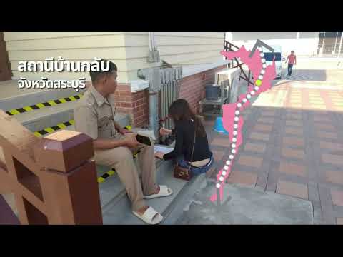
Thumbnail for DLT วิดิทัศน์ประกอบโครงการ 3 นาที by everdale

DLT วิดิทัศน์ประกอบโครงการ 3 นาที

everdale

3m 13s372 words~2 min read
YouTube auto captions
Transcript source

YouTube auto captions

This transcript was extracted from YouTube's auto-generated caption track. The transcript below is server-rendered so it can be read, searched, cited, and shared without opening the original YouTube player.

AI Video Summary

This video discusses a pilot project in Thailand aimed at improving the connectivity between road and rail transport. Despite a variety of transportation options, including personal vehicles, motorcycles, walking, cycling, public buses, and long-distance trains, the current system lacks efficient integration. This leads to inconvenience, delays, and an increased risk of accidents. The project's main objective is to study accident risks at these transport connection points, specifically focusing on the journey from train stations to final destinations.

The project covers two main routes: the Bangkok-Pak Nam Pho route in the North (21 stations from Bang Pa-in to Pak Nam Pho) and the Bangkok-Chumphon route in the South (44 stations from Salaya to Chumphon). These routes encompass several important provinces, including Phra Nakhon Si Ayutthaya, Saraburi, Lopburi, Nakhon Sawan in the North, and Nakhon Pathom, Ratchaburi, Phetchaburi, Prachuap Khiri Khan, and Chumphon in the South. The methodology involves on-site surveys, collecting travel behavior data, assessing safety to identify risk points, conducting focus group discussions with relevant agencies, and finally, developing recommendations tailored for Thailand.

The ultimate goal of this project is to create a convenient, safe, and efficiently connected transportation system. This will enhance the quality of life for citizens and lay the groundwork for a sustainable transport system in the future. The project emphasizes that good travel isn't just about reaching a destination, but about ensuring safety throughout the entire journey.

Key Takeaways

  • Thai transportation currently lacks efficient connectivity between diverse modes, causing inconvenience, delays, and accident risks.
  • A pilot project is underway to study and improve the integration of road and rail transport.
  • The project's primary goal is to analyze accident risks at connection points between train stations and final destinations.
  • Two main routes are being studied: Bangkok-Pak Nam Pho (North) covering 21 stations and Bangkok-Chumphon (South) covering 44 stations.
  • The methodology includes on-site surveys, travel behavior data collection, safety assessments, and stakeholder consultations.
  • Recommendations will be developed to create a suitable and integrated transport system for Thailand.
  • The project aims to enhance convenience, safety, and connectivity, improving quality of life and fostering sustainable transportation.

Topics Covered

TransportationRoad-Rail ConnectivityTraffic SafetyUrban PlanningInfrastructure Development
Pull quotes
[1:44]รวม ถึง สาย ใต้ ที่ มี ทั้ง จังหวัด นครปฐม ราชบุรี เพชรบุรี ประจวบ คีรี ขันธ์ และ ชุมพร
Use this transcript
Related transcript hubs

[0:03]ใน ปัจจุบัน การ เดิน ทาง ของ คน ไทย มี ความ หลาก หลาย มาก ขึ้น ทั้ง รถ ยนต์ ส่วน ตัว รถ จักรยาน ยนต์ การ เดิน เท้า การ ปั่น จักรยาน รวม ถึง การ ใช้ รถ โดย สาร สาธารณะ และ รถ ไฟ ใน ระยะ ทาง ไกล แต่ แม้ จะ มี ตัว เลือก ที่ หลาก หลาย การ เดิน ทาง ยัง คง ขาด ความ เชื่อม ต่อ ที่ มี ประสิทธิภาพ ส่ง ผล ให้ เกิด ความ ไม่ สะดวก ความ ล่า ช้า และ เพิ่ม ความ เสี่ยง ต่อ อุบัติเหตุ ใน การ เดิน ทาง จาก ปัญหา เหล่า นี้ จึง เป็น ที่ มา ของ โครง การ นํา ร่อง เพื่อ ศึกษา แนว ทาง การ เชื่อม ต่อ การ ขน ส่ง ทาง ถนน กับ การ ขน ส่ง ทาง ราง โดย มี วัตถุประสงค์ สําคัญ 5 ประการ ศึกษา ความ เสี่ยง อุบัติเหตุ ใน การ เชื่อม ต่อ การ เดิน ทาง เพื่อ ศึกษา ปัจจัย เสี่ยง หรือ ความ ไม่ ปลอด ภัย ใน การ เชื่อม ต่อ การ เดิน ทาง จาก สถานี รถ ไฟ ไป จุด หมาย ปลาย ทาง โครง การ ครอบ คลุม การ ศึกษา 2 เส้น ทาง หลัก ได้ แก่ เส้น ทาง กรุงเทพมหานคร ปาก น้ํา โพธิ์ ใน สาย เหนือ จํานวน 21 สถานี ตั้ง แต่ สถานี บางปะอิน ถึง สถานี ปาก น้ํา โพธิ์ และ เส้น ทาง กรุงเทพมหานคร ชุมพร ใน สาย ใต้ จํานวน 44 สถานี ตั้ง แต่ สถานี ศาลา ยา ถึง สถานี ชุมพร โดย ครอบ คลุม พื้นที่ สําคัญ หลาย จังหวัด ใน สาย เหนือ มี ทั้ง จังหวัด พระ นคร ศรี อยุธยา สระบุรี ลพบุรี นครสวรรค์

[1:44]รวม ถึง สาย ใต้ ที่ มี ทั้ง จังหวัด นครปฐม ราชบุรี เพชรบุรี ประจวบ คีรี ขันธ์ และ ชุมพร

[2:32]เริ่ม จาก การ สํารวจ พื้นที่ จริง ต่อ ด้วย การ เก็บ ข้อ มูล พฤติกรรม การ เดิน ทาง จาก นั้น คือ การ ประเมิน ความ ปลอด ภัย เพื่อ ระบุ จุด เสี่ยง พร้อม ทั้ง การ ประชุม สนทนา กลุ่ม เพื่อ รับ ฟัง ความ คิด เห็น จาก หน่วย งาน ที่ เกี่ยว ข้อง และ สุด ท้าย การ จัด ทํา ข้อ เสนอ แนะ เพื่อ พัฒนา แนว ทาง ให้ เหมาะ สม กับ ประเทศ ไทย โครง การ นี้ มุ่ง เน้น การ สร้าง การ เดิน ทาง ที่ สะดวก ปลอด ภัย และ เชื่อม โยง กัน อย่าง มี ประสิทธิภาพ เพื่อ ยก ระดับ คุณภาพ ชีวิต ของ ประชาชน และ วาง ราก ฐาน สู่ ระบบ ขน ส่ง ที่ ยั่ง ยืน ใน อนาคต เพราะ การ เดิน ทาง ที่ ดี ไม่ ใช่ แค่ ไป ถึง จุด หมาย แต่ ต้อง ปลอด ภัย ใน ทุก เส้น ทาง


Need another transcript?

Paste any YouTube URL to get a clean transcript in seconds.

Get a Transcript