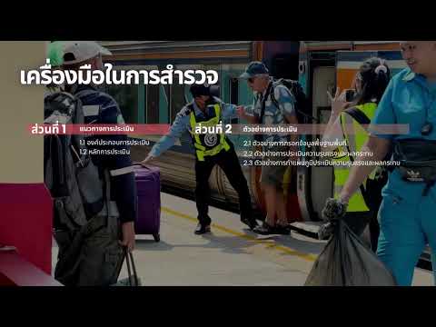
Thumbnail for DLT วิดิทัศน์ประกอบโครงการ 7 นาที by everdale

DLT วิดิทัศน์ประกอบโครงการ 7 นาที

everdale

7m 18s504 words~3 min read
YouTube auto captions
Transcript source

YouTube auto captions

This transcript was extracted from YouTube's auto-generated caption track. The transcript below is server-rendered so it can be read, searched, cited, and shared without opening the original YouTube player.

AI Video Summary

This project addresses the growing but disconnected transportation landscape in Thailand, where various modes of travel, including personal vehicles, motorcycles, walking, cycling, and public transport like buses and trains, lack efficient integration. This fragmentation leads to inconvenience, delays, and increased accident risks. To tackle these issues, a pilot project was initiated to study ways to connect road transport with rail transport, aiming for five key objectives. The study focuses on two main routes: the Bangkok-Pak Nam Pho route in the North, covering 21 stations from Bang Pa-in to Pak Nam Pho, and the Bangkok-Chumphon route in the South, spanning 44 stations from Salaya to Chumphon. These routes encompass several important provinces, including Ayutthaya, Saraburi, Lopburi, Nakhon Sawan in the North, and Nakhon Pathom, Ratchaburi, Phetchaburi, Prachuap Khiri Khan, and Chumphon in the South.

The project involved knowledge dissemination, discussions with relevant agencies, public relations, and presenting study results from four pilot stations. At Lopburi Station, where pedestrian access is currently difficult, a pedestrian walkway was designed to connect the station with the surrounding community, along with adding transit transfer areas and waiting spaces. Nakhon Sawan Station faces issues with disorderly parking and a small passenger drop-off area; the proposal includes improving parking and creating a roundabout at the station front for easier passenger drop-off and pick-up. Nakhon Pathom Station has accessibility problems by car due to its long, narrow layout and narrow roads; solutions proposed include road widening and adding transit hubs with bus and van stops in front of the station. Chumphon Station struggles with disorganized parking, lack of information signs, and insufficient transit transfer areas; the project suggests increasing parking for public transport vehicles and installing clear signage and travel information near the station.

Ultimately, this project aims to create convenient, safe, and efficiently connected travel, improving the quality of life for citizens and laying the groundwork for a sustainable transportation system in the future. The emphasis is not just on reaching a destination, but on ensuring safety throughout the entire journey.

Key Takeaways

  • Thai transportation currently suffers from a lack of efficient connectivity between various modes, leading to inconvenience, delays, and accident risks.
  • A pilot project was launched to integrate road and rail transport, focusing on five key objectives.
  • The study covers two major rail routes: Bangkok-Pak Nam Pho (North, 21 stations) and Bangkok-Chumphon (South, 44 stations), spanning multiple provinces.
  • Specific proposals were developed for four pilot stations to improve accessibility and connectivity: Lopburi (pedestrian access), Nakhon Sawan (parking and drop-off), Nakhon Pathom (road access and transit hubs), and Chumphon (parking and information).
  • Solutions include designing pedestrian walkways, improving parking and drop-off areas, widening roads, and adding public transport stops and signage.
  • The project's goal is to enhance travel convenience, safety, and efficiency, thereby improving the quality of life and establishing a sustainable transport system.
  • The overarching principle is that good travel encompasses not just reaching the destination, but also ensuring safety throughout the journey.

Topics Covered

Transportation IntegrationRail TransportUrban PlanningPublic InfrastructureSustainable Mobility
Timestamped outline
[0:04]Section 1

ใน ปัจจุบัน การ เดิน ทาง ของ คน ไทย มี ความ หลาก หลาย มาก ขึ้น ทั้ง รถ ยนต์ ส่วน ตัว รถ จักรยาน ยนต์ การ เดิน เท้า การ ปั่น จักรยาน รวม ถ...

[0:56]Section 2

โครงการ ครอบ คลุม การ ศึกษา 2 เส้น ทาง หลัก ได้แก่ เส้น ทาง กรุงเทพ มหานคร ปากน้ำ โพธิ์ ใน สาย เหนือ จำนวน 21 สถานี ตั้ง แต่ สถานี บาง ปะ...

[1:44]Section 3

รวม ถึง สาย ใต้ ที่ มี ทั้ง จังหวัด นครปฐม ราชบุรี เพชรบุรี ประจวบคีรีขันธ์ และ ชุมพร

[5:32]Section 4

การ จัด อบรม เผยแพร่ ความ รู้ และ หารือ กับ หน่วย งาน ที่ เกี่ยวข้อง

[5:43]Section 5

จะ คิด ยัง ไง อย่าง วัน ก่อน การ จัด ประชาสัมพันธ์ และ นำ เสนอ ผล การ ศึกษา จาก พื้นที่ สถานี นำ ร่อง 4 สถานี สถานี ลพบุรี 2 ใน ปัจจุบัน...

Pull quotes
[1:44]รวม ถึง สาย ใต้ ที่ มี ทั้ง จังหวัด นครปฐม ราชบุรี เพชรบุรี ประจวบคีรีขันธ์ และ ชุมพร
Use this transcript
Related transcript hubs

[0:04]ใน ปัจจุบัน การ เดิน ทาง ของ คน ไทย มี ความ หลาก หลาย มาก ขึ้น ทั้ง รถ ยนต์ ส่วน ตัว รถ จักรยาน ยนต์ การ เดิน เท้า การ ปั่น จักรยาน รวม ถึง การ ใช้ รถ โดย สาร สาธารณะ และ รถ ไฟ ใน ระยะ ทาง ไกล แต่ แม้ จะ มี ตัว เลือก ที่ หลาก หลาย การ เดิน ทาง ยัง คง ขาด ความ เชื่อม ต่อ ที่ มี ประสิทธิภาพ ส่ง ผล ให้ เกิด ความ ไม่ สะดวก ความ ล่า ช้า และ เพิ่ม ความ เสี่ยง ต่อ อุบัติเหตุ ใน การ เดิน ทาง จาก ปัญหา เหล่า นี้ จึง เป็น ที่ มา ของ โครงการ นํา ร่อง เพื่อ ศึกษา แนว ทาง การ เชื่อม ต่อ การ ขนส่ง ทาง ถนน กับ การ ขนส่ง ทาง ราง โดย มี วัตถุประสงค์ สำคัญ 5 ประการ

[0:56]โครงการ ครอบ คลุม การ ศึกษา 2 เส้น ทาง หลัก ได้แก่ เส้น ทาง กรุงเทพ มหานคร ปากน้ำ โพธิ์ ใน สาย เหนือ จำนวน 21 สถานี ตั้ง แต่ สถานี บาง ปะอิน ถึง สถานี ปากน้ำ โพธิ์ และ เส้น ทาง กรุงเทพ มหานคร ชุมพร ใน สาย ใต้ จำนวน 44 สถานี ตั้ง แต่ สถานี ศาลา ยา ถึง สถานี ชุมพร โดย ครอบ คลุม พื้นที่ สําคัญ หลาย จังหวัด ใน สาย เหนือ มี ทั้ง จังหวัด พระ นคร ศรีอยุธยา สระบุรี ลพบุรี นครสวรรค์

[1:44]รวม ถึง สาย ใต้ ที่ มี ทั้ง จังหวัด นครปฐม ราชบุรี เพชรบุรี ประจวบคีรีขันธ์ และ ชุมพร

[5:32]การ จัด อบรม เผยแพร่ ความ รู้ และ หารือ กับ หน่วย งาน ที่ เกี่ยวข้อง

[5:43]จะ คิด ยัง ไง อย่าง วัน ก่อน การ จัด ประชาสัมพันธ์ และ นำ เสนอ ผล การ ศึกษา จาก พื้นที่ สถานี นำ ร่อง 4 สถานี สถานี ลพบุรี 2 ใน ปัจจุบัน มี ปัญหา ใน การ เข้า ถึง ด้วย การ เดิน เท้า และ บริเวณ รอบ สถานี จึง ออก แบบ ทาง เดิน เท้า เพื่อ เชื่อม พื้นที่ สถานี และ พื้นที่ ชุมชน โดย รอบ และ เพิ่ม พื้นที่ การ เปลี่ยน ถ่าย การ สัญจร และ พื้นที่ นั่ง พัก คอย ของ ผู้ ใช้ บริการ สถานี นครสวรรค์ ปัจจุบัน บริเวณ รอบ สถานี มี ปัญหา ใน พื้นที่ จอด รถ ไม่ เป็น ระเบียบ และ พื้นที่ รับ ส่ง ผู้ โดยสาร ด้าน หน้า สถานี มี ขนาด เล็ก จึง เสนอ ให้ ปรับ ปรุง พื้นที่ จอด รถ และ จัด พื้นที่ เปลี่ยน ถ่าย การ สัญจร บริเวณ หน้า สถานี ให้ มี วงเวียน ทํา ให้ ง่าย ต่อ การ รับ ส่ง ผู้ โดยสาร สถานี นครปฐม ปัจจุบัน มี ปัญหา ใน การ เข้า ถึง โดย รถยนต์ เนื่อง จาก พื้นที่ สถานี เป็น แนว ยาว และ ความ กว้าง ของ ถนน มี ความ แคบ ซึ่ง มี การ เสนอ ให้ ขยาย ถนน และ เพิ่ม จุด เปลี่ยน ถ่าย การ สัญจร ให้ มี ป้าย รถ เมล์ และ รถ ตู้ อยู่ หน้า สถานี สถานี ชุมพร ปัจจุบัน มี ปัญหา ใน พื้นที่ จอด รถ ไม่ เป็น ระเบียบ ไม่ มี ป้าย บอก ข้อ มูล และ ขาด พื้นที่ การ เปลี่ยน ถ่าย การ สัญจร จึง เสนอ ให้ เพิ่ม พื้นที่ จอด สำหรับ รถ ขนส่ง สาธารณะ และ ติด ป้าย บอก ทาง และ ข้อ มูล การ เดิน ทาง บริเวณ สถานี โครงการ นี้ มุ่ง เน้น การ สร้าง การ เดิน ทาง ที่ สะดวก ปลอดภัย และ เชื่อม โยง กัน อย่าง มี ประสิทธิภาพ เพื่อ ยก ระดับ คุณภาพ ชีวิต ของ ประชาชน และ วาง ราก ฐาน สู่ ระบบ ขนส่ง ที่ ยั่ง ยืน ใน อนาคต เพราะ การ เดิน ทาง ที่ ดี ไม่ ใช่ แค่ ไป ถึง จุด หมาย แต่ ต้อง ปลอดภัย ใน ทุก เส้น ทาง


Need another transcript?

Paste any YouTube URL to get a clean transcript in seconds.

Get a Transcript